
Lower Laguna Madre – Brownsville Ship Channel Water Quality Monitoring
Cameron, Hidalgo, and Willacy Counties, Texas
This project consists of collecting water quality and hydrologic data to characterize sub-basin contributions of Non-Point Source (NPS) pollution constituents of concern to Brownsville Ship Channel and the impaired San Martin Lake.
Project Overview
- Contract Number: 582-26-00129
- Funding Source: EPA-TCEQ
- Project Start: 09/30/2025
- Project Completion: 08/31/2027
- (48 months)
- Project Type: 604 (B)
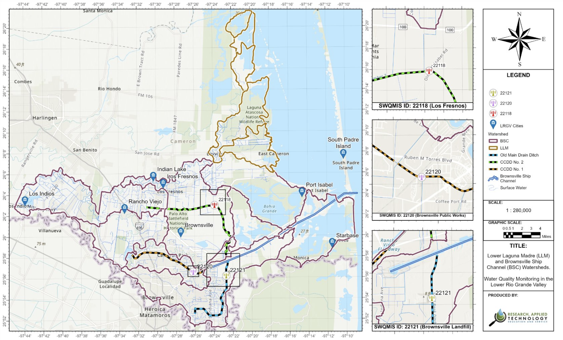
Previous Efforts
LLM/BSC Watershed Characterization (UTRGV/TWRI)
Performance Period: 09/01/15 – 08/31/18
Project Outcomes:
- Sub-basin delineation
- Routine monitoring sampling along the Ship Channel and Port Isabel causeway landing.
- NPS Characterization
Status: Project Closed
LLM/BSC Watershed Protection Plan Phase I (UTRGV/RATES)
Performance Period: 09/01/19 – 08/31/2022
Project Outcomes:
- Watershed delineation
- Continuous water quality monitoring, bacteria coliforms (E. Coli) modeling.
- Development of LDC’s and SELECT models
- Installation of 3 RTHS Stations
Status: Project Closed
Water Quality Monitoring (Instantaneous Measurements)
- RATES will collect samples and in-situ field measurements at a quarterly rate.
- In-situ field measurements will include:
- pH, specific conductance, dissolved oxygen, water temperature and flow. Parameters measured in grab samples include Nitrate + Nitrite; Total-Kjeldahl Nitrogen; Total Phosphorus; and bacteria (E. Coli).
- Results will be submitted into the TCEQ Surface Water Quality Monitoring Information System (SWQMIS).
Hydrologic Monitoring (Continuous Measurements)
- The RTHS stations will continuously measure:
- Barometric pressure, water temperature, and stage height at three previously installed SWQM monitoring stations (Station IDs: 22118, 22120, and 22121).
- Service visits twice each year to ensure quality of continuous monitoring equipment.
- Continuous hydrologic data supports modeling efforts such as load duration curves and tidal flux analysis in estuarine segments.