Texas Water Development Board (TWDB) / Lower Rio Grande Valley Development Council (LRGVDC)– Flood Infrastructure Fund (FIF) Category 1: Lower Rio Grande Valley Flood Protection Planning, Cameron, Hidalgo, and Willacy Counties, TX
2021 – Present
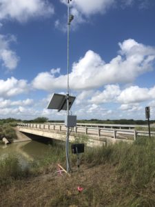
Pending contract execution, RATES is partnering with the LRGVDC to implement a regional coordination and science-driven decision-making network in which data from both new and existing data sources will be coupled with H & H models. Models will be developed which incorporate data from T 40 new Real-Time Hydrologic Stations (RTHS) across the region’s major drainage network, which are being commissioned as part of the project. Decision-making tools will include early flood warning alerts based on data from strategically placed sites in flood-prone areas, local H & H model forecasts which incorporate RTHS data for improved regional accuracy over existing forecasts such as the National Water Model (which is known to be deficient in regions such as the LRGV), and modelling tools which will aid in the planning of structural and non-structural controls for flood mitigation efforts for regional (Tier 1: HUC-8), Sub-regional (Tier 2: HUC-10), Urban (Tier 3) and Project-Specific (Tier 4) initiatives. The cyberinfrastructure and tools are to be developed for each these tiers such that they can utilized not only for this project, but in complementary FIF projects of all categories.
Texas Water Development Board (TWDB) – Freshwater Flows, Cameron and Willacy Counties, TX
2021 – Present
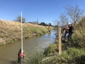
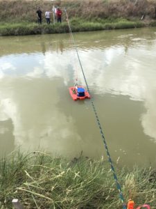
RATES is the technical lead for monitoring program to characterize flow and water quality of four (4) Lower Laguna Madre Tributaries. Project involves operation of continuous monitoring station of each tributaries to measure water quality and hydrologic parameters (including stream level) in combination with quarterly monitoring events. Data will be applied to address management of hydrologic flows to ensure the health of the ecologically sensitive hypersaline Lower Laguna Madre. RTHS stations commissioned through this project will included in the Lower Rio Grande Valley-Regional River and Estuary Observatory network that is being implemented as part of LRGVDC Regional TWDB Flood Infrastructure Fund project.
Texas Commission on Environmental Quality (TCEQ) § 319 Projects, Cameron, Hidalgo, and Willacy Counties, TX
2019 – Present
RATES serves in a technical advisory capacity in support of two TCEQ Watershed Protection Plans: 1) Lower Laguna Madre-Brownsville Ship Channel Watershed Characterization; and 2) North and Central Watershed Characterization. RATES has developed the River and Estuary Observation Network- Rio Grande Valley (REON-RGV) that serves as the central repository and public access point for all watershed characterization data that is compiled and generated through the project. REON-RGV is further being leveraged to serve as the regional data base, through which for data and models developed through the LRGV-Regional Flood Infrastructure Fund project will be served. RATES also supports field data collection events, Quality Assurance Project Planning, and watershed modeling activities.
Woodbury Creek / Swamp River Monitoring, Orange and Dutchess Counties, NY
2017 – Present
RATES is contracted by The Chazen Companies to perform water monitoring for two projects located in southeastern New York State. For these projects, RATES operates RTHS systems at several locations to continuously monitor and record the water level at several stream locations and in selected residential wells. All data is automatically archived and RATES servers and made available to the client for graphical visualization and download via the REON cyberinfrastructure.
Indian River Observatory Network (IRON), St. Lawrence, Jefferson, and Lewis Counties, NY
2019 – 2020
With funding from the NY Department of Environmental Conservation (DEC), RATES, in collaboration with the Indian River Lakes Conservancy, established the IRON Network (as a subset of REON) in the Indian River Watershed, a HUC-8 watershed containing several impaired lakes. RATES authored a Quality Assurance Project Plan (QAPP) regarding the siting, installation, and operation, of 10 monitoring stations throughout the watershed, which was approved by the DEC. RATES identified suitable locations, received permission for installation from property owners (individuals in some cases, local and state government entities in others), and installed the 10 stations in accordance with the QAPP and in compliance with state and local regulations. The stations are equipped with sensors for stage height and for assorted meteorological parameters, and can be further equipped with sensor instrumentation for various water quality parameter as needed. RATES operates the IRON network in conjunction with the IRLC and with local Lake Associations, and works with these and other organizations to pursue research initiatives utilizing these IRON network.
Characterization of sturgeon spawning habitats, St. Lawrence County, NY
2013 – 2014
Project funded by USEPA (USEPA GL-9722140) through St. Regis Mohawk Tribe. RATES provided monitoring services to characterize hydrodynamics and water quality for known spawning habitats the St. Lawrence River and tributaries. Data was subsequently applied in HEC-RAS to predict water depths and velocities over the studied river reaches.
River and Estuary Observatory Network (REON) –Implementation across Hudson River Watershed, New York State
2008 – 2015
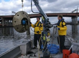
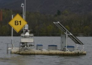
With funding from the Dormitory Authority of the State of New York (DASNY), RATES, in conjunction with Clarkson University, implemented a network of 40 RTHS stations at various locations throughout the Hudson River Watershed. These stations monitored water level and precipitation using sensors designed by a Clarkson University Masters Student, as well as various meteorological sensors. Several of the Hudson River stations were equipped with Acoustic Doppler Current Profilers (ADCPs) which monitored river flow and discharge (using discharge correlations obtained via vessel-mounted ADCP transects taken over complete tidal cycles). This original implementation of REON also included the deployment of several profiling platforms, which were deployed seasonally to continuously collect water-quality data throughout the water column.
